No products in the cart.
Harnessing Satellites and AI for Climate Action

Satellites and AI are transforming climate action by providing unprecedented environmental data. Explore their impact on careers and innovation.
Washington, D.C. — As the urgency of climate change escalates, the role of satellites and artificial intelligence (AI) in monitoring environmental shifts is becoming more crucial. This technology is not only revolutionizing how scientists track changes in the Earth’s climate but also shaping the future of careers in environmental science, data analytics, and technology.
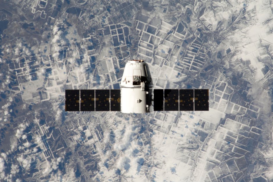
Satellites equipped with advanced sensors and AI algorithms are now capable of providing real-time data on deforestation, urbanization, and atmospheric changes. This information is vital for governments, researchers, and businesses looking to mitigate the impacts of climate change.
The significance of this technological advancement cannot be overstated. According to a report from the European Space Agency, satellite observations can improve the accuracy of climate models by over 30%[1]. As organizations increasingly rely on data-driven decisions, the demand for professionals skilled in interpreting satellite data and utilizing AI is surging.
Context and Background
Historically, environmental monitoring has relied on ground-based observations, which are often limited in scope and frequency. However, with the launch of satellite constellations such as Planet Labs’ Doves and the European Space Agency’s Sentinel satellites, the ability to gather comprehensive data has expanded dramatically.
 Ethics
Exploring the Next Frontier in Biotechnology: Gene Therapy and Ethics
Dive into the world of gene therapy and synthetic biology, exploring their potential and ethical considerations in human enhancement.
Read More →As organizations increasingly rely on data-driven decisions, the demand for professionals skilled in interpreting satellite data and utilizing AI is surging.
For instance, Planet Labs operates a fleet of over 200 satellites that capture images of the entire Earth daily. This level of monitoring allows for unprecedented insights into changes in land use, agricultural trends, and natural disasters, providing essential data for climate action initiatives[2].
Moreover, AI enhances this data collection process by analyzing vast amounts of information quickly and accurately. Machine learning algorithms can identify patterns and anomalies in satellite imagery that would be challenging for human analysts to detect. This synergy between AI and satellite technology is pivotal in developing responsive strategies to combat climate change.

Analysis of Perspectives
Experts agree that the integration of AI with satellite data is likely to redefine environmental policy and business strategies. For instance, a 2023 study by McKinsey & Company highlights that companies leveraging satellite data for sustainability efforts could see a 15% reduction in operational costs while improving their environmental impact[3].
However, challenges remain. The ethical implications of surveillance and data privacy are concerns that must be addressed as satellite technology becomes more ubiquitous. Additionally, there is a pressing need for interdisciplinary collaboration among scientists, policymakers, and technologists to ensure that the data collected is used effectively and responsibly.
 Global Affairs
India Extends Cyclone Relief to Sri Lanka’s North
India has launched Operation Sagar Bandhu to assist Sri Lanka's northern regions impacted by Cyclone Ditwah, providing vital humanitarian and…
Read More →Furthermore, the job market is evolving. According to the World Economic Forum, jobs related to environmental monitoring and data analysis are expected to grow by 30% in the next five years[4]. This growth presents an opportunity for professionals to pivot into emerging fields that prioritize sustainability.
This growth presents an opportunity for professionals to pivot into emerging fields that prioritize sustainability.
Future Implications
Looking ahead, the potential applications of satellite and AI technologies in climate action are vast. Companies are beginning to adopt these tools for carbon footprint tracking, supply chain management, and compliance with environmental regulations. The integration of real-time satellite data into corporate decision-making processes could lead to more sustainable business practices.
Moreover, educational institutions are recognizing this shift. Programs focusing on environmental science, data analytics, and AI are increasingly being developed to equip the next generation of leaders with the skills needed to navigate this new landscape.
The convergence of satellite technology and AI is not just a technological advancement; it is a catalyst for systemic change in how we approach environmental issues. As we move forward, the question remains: How can we ensure that this powerful technology is harnessed for the benefit of all, rather than a select few? The path we choose will have profound implications for future generations.
 Tech & Science
The Great Re-skill: Gen Z’s Path to Employability
Gen Z is redefining employability through continuous learning. Explore their innovative approaches to career development post-degree.
Read More →