No products in the cart.
How Satellite Data Is Revolutionizing Earth’s Agriculture, Climate, and Health Forecasts

Satellite data is revolutionizing agriculture, climate monitoring, and health forecasting worldwide, offering precise, timely insights that improve decision-making and resilience.
Washington, D.C. — Satellite technology is increasingly central to addressing Earth’s most urgent challenges. From enhancing agricultural yields and optimizing water use to improving climate models and predicting disease outbreaks, space-based data is reshaping how scientists, policymakers, and industries respond to global problems. In recent years, agencies including NASA, the European Space Agency (ESA), and private firms like Planet Labs have deployed constellations of Earth-observing satellites that provide near-real-time data with unprecedented resolution. This surge in accessible satellite information enables detailed monitoring of crop health, soil moisture, atmospheric conditions, and environmental hazards. The integration of this data into decision-making processes is driving smarter, more sustainable practices in food production, climate adaptation, and public health preparedness. As climate shocks intensify and the global population nears 8.2 billion, the ability to harness space science for terrestrial solutions has never been more critical. Satellite data not only informs immediate responses but also helps forecast long-term trends, enhancing resilience across sectors. Understanding the scope and impact of this technology is essential for professionals and policymakers aiming to navigate the complex intersections of environment, economy, and human well-being.
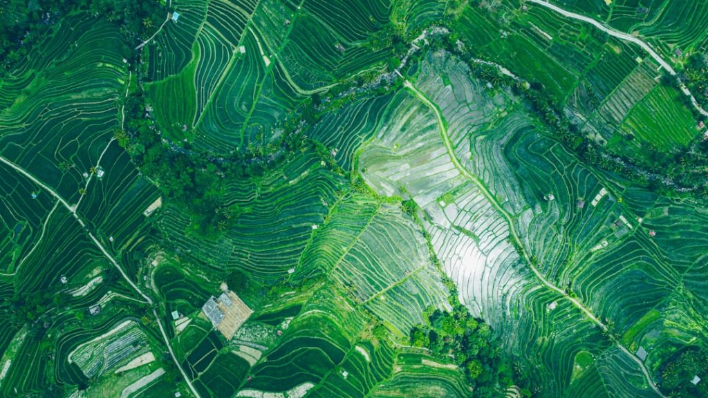
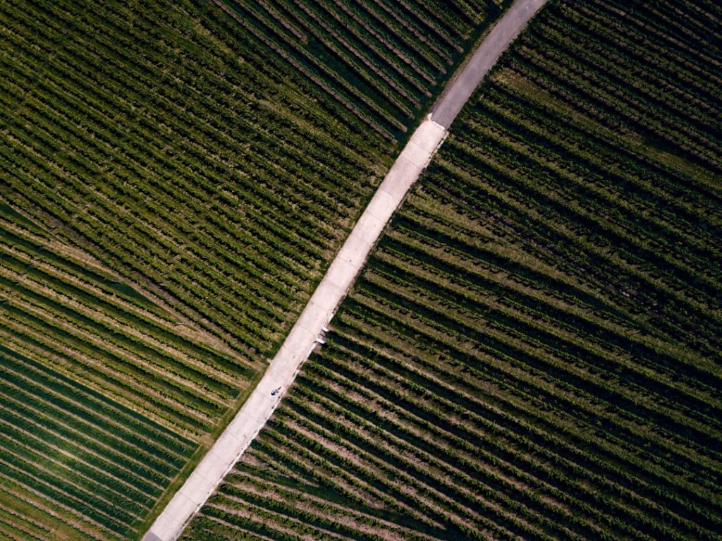
Satellite Data Elevates Modern Agriculture
Precision agriculture has emerged as one of the most promising applications of satellite data. By using multispectral imagery and synthetic aperture radar, farmers and agronomists can assess crop health, detect pest infestations early, and optimize irrigation schedules based on soil moisture data. The USDA’s Crop Condition and Soil Moisture Analytics program, leveraging satellite inputs, reported a 15% improvement in water use efficiency across participating states in 2024[1]. Private sector innovations have complemented government efforts. Companies like Planet Labs operate daily imaging satellites that generate high-frequency updates, allowing farmers to monitor fields in near real time. This capability supports rapid interventions, reducing crop losses and input waste. In India, the Indian Space Research Organisation (ISRO) collaborates with local agencies to distribute satellite-guided advisories to smallholder farmers, improving yields by up to 20% in pilot regions[2]. Satellite data also enhances supply chain transparency by enabling governments and corporations to track crop conditions across vast geographies. This information helps anticipate food shortages and price volatility, critical for global food security as climate change disrupts traditional agricultural zones.
 Career Development
What After a Journalism Degree? Careers in Media, PR, and Digital
Discover a range of career opportunities for journalism graduates, from media to PR and digital content creation, along with essential…
Read More →Advancing Climate Science with Earth Observation
Climate modeling has benefited profoundly from satellite observations. Instruments like NASA’s MODIS and ESA’s Sentinel satellites provide continuous monitoring of atmospheric gases, land surface temperatures, ice cover, and ocean currents. These datasets refine climate projections and validate ground-based measurements, reducing uncertainty in forecasts essential for policy and adaptation planning. Recent advances include the integration of satellite-derived greenhouse gas concentrations with machine learning algorithms to identify emission hotspots. The Global Carbon Project’s 2025 report attributes a 12% improvement in national emissions inventories accuracy to these methods[3]. This precision underpins international climate negotiations and enforcement of emissions targets. Moreover, satellites enable near-instant detection of extreme weather events such as hurricanes, droughts, and floods. The World Meteorological Organization highlighted that satellite data contributed to a 30% increase in early warning lead times globally between 2018 and 2024, allowing more effective disaster preparedness and response[4].
Recent advances include the integration of satellite-derived greenhouse gas concentrations with machine learning algorithms to identify emission hotspots.

Health Forecasting and Disease Surveillance from Space
Public health is an emerging frontier for satellite applications. Space-based sensors track environmental factors linked to disease outbreaks, including temperature, humidity, and vegetation patterns that influence vectors like mosquitoes. During the 2023 Zika virus resurgence in Brazil, satellite data helped predict outbreak zones by monitoring rainfall and standing water accumulation, enabling targeted interventions. Agencies like the Centers for Disease Control and Prevention (CDC) are increasingly integrating satellite data into epidemiological models. These tools improve forecasts for seasonal influenza, dengue fever, and other climate-sensitive diseases by incorporating environmental variables inaccessible through traditional surveillance alone. This approach supports proactive resource allocation and vaccination campaigns. Furthermore, satellite communication networks facilitate telemedicine in remote areas, strengthening healthcare delivery in underserved regions. The World Health Organization has endorsed several satellite-enabled projects that expanded healthcare access to 10 million people across Africa and Asia in 2024.
 Education
Yale Professors’ Donations Highlight Political Bias Amid Scrutiny
A recent analysis reveals that Yale professors overwhelmingly support Democratic candidates, sparking debate about political bias in academia.
Read More →Balancing Opportunity with Challenges
Despite its promise, the deployment of satellite data faces hurdles. Data accessibility and standardization remain uneven, particularly in developing countries. High costs associated with advanced satellite technologies and data processing infrastructure limit adoption outside major economies. Privacy and security concerns also arise as satellite imagery becomes more granular and widespread. Legal frameworks governing data use and sharing are still evolving. The European Union’s Space Data Governance Act, passed in 2025, attempts to address these issues by establishing clear protocols for commercial and government satellite data utilization. Technological challenges include managing vast data volumes and ensuring interoperability between different satellite systems and ground-based sensors. Investments in cloud computing and artificial intelligence are crucial to harness the full potential of Earth observation data.
Looking Ahead: A New Era of Data-Driven Earth Stewardship
As space science continues to advance, the fusion of satellite data with artificial intelligence and IoT devices will accelerate decision-making across agriculture, climate resilience, and health sectors. Professionals in these fields must develop fluency in interpreting and applying satellite-derived insights to remain competitive and effective. International collaboration will be vital to democratize access to satellite data, ensuring that low- and middle-income countries can leverage these tools to meet sustainable development goals. Policymakers should prioritize investments in infrastructure and regulatory frameworks that foster innovation while safeguarding ethical standards. Ultimately, the expanding role of satellite data marks a shift toward more anticipatory and adaptive management of Earth’s resources and risks. For career seekers and educators, this signals growing demand for expertise at the intersection of space science, data analytics, and applied problem-solving.
 Education
Why UGC’s Equity Rules on Caste Discrimination Are Controversial
UGC's new equity rules aimed at addressing caste discrimination face backlash from various quarters, raising concerns over their definitions and…
Read More →